A geotechnical engineering firm was engaged to investigate ground conditions for a proposed commercial development.
The investigation involved multiple boreholes, test pits, sampling locations and groundwater monitoring points spread across the site. Over several weeks, field technicians and engineers conducted site visits to collect information required for design and engineering assessments.
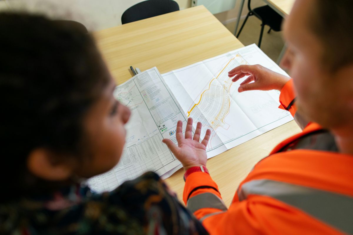
Each investigation activity generated valuable information including photos, field observations, soil descriptions, sampling records and testing results. The project team required a practical way to organise this information and ensure every record remained connected to the location where it was collected.
Geotechnical investigations generate large amounts of location-based information.
A borehole may be drilled during one site visit, sampled during another and referenced months later when engineering reports are being prepared. Additional observations may be recorded by different technicians throughout the project.
As information accumulates, records often become spread across notebooks, spreadsheets, reports, photos, emails and project folders.
While all the information exists, understanding where it was collected and how it relates to the rest of the site can become difficult.
Engineers frequently need to answer questions such as:
Without a visual system linking records to locations, valuable time can be spent searching through documentation to reconstruct the investigation history.
The geotechnical team implemented Live Site Map as a shared field information platform for the project.
The project boundary and investigation plan were uploaded, allowing boreholes, test pits, monitoring points and field observations to be recorded directly against their physical location.
As fieldwork progressed, technicians recorded information against each investigation point, creating a visual record of site activities.
Photos, observations, notes and supporting documentation remained connected to the exact location where they were collected.
Rather than relying on multiple disconnected systems, the project team developed a central source of truth for investigation information.
Boreholes and test pits form the foundation of most geotechnical investigations.
During the project, each investigation location was recorded within Live Site Map, allowing field personnel to attach observations, photographs and supporting records directly to the investigation point.
Engineers reviewing the project could immediately understand where information was collected and how each investigation point related to surrounding site conditions.
This reduced the need to cross-reference drawings, spreadsheets and field notes when reviewing investigation data.
Not every important piece of information appears in a formal borehole log.
Surface conditions, drainage paths, signs of erosion, existing structures and unexpected ground conditions can all influence engineering decisions.
Live Site Map allowed these observations to be recorded directly against the location where they occurred.
This created a richer project record and ensured valuable field knowledge remained available throughout the investigation.
Geotechnical investigations rarely occur in a single visit.
Additional sampling, groundwater monitoring, verification work and engineering reviews often take place over an extended period.
Multiple technicians and engineers may contribute information throughout the project lifecycle.
By maintaining all records within a shared visual workspace, project teams could easily review previous observations, understand historical site conditions and build upon information collected during earlier visits.
This reduced duplication of effort and improved continuity across the project team.
One of the most significant challenges in geotechnical investigations is ensuring office-based engineers have access to the same information collected in the field.
Using Live Site Map, field personnel could capture records while on site and make them immediately available to the wider project team.
Engineers reviewing investigation results could view records within the context of the site, making it easier to interpret findings and prepare recommendations.
The visual nature of the system also improved communication between project stakeholders who may not have visited the site themselves.
Boreholes, test pits, monitoring points and observations remained connected to their location throughout the project.
Project teams could quickly review records collected during previous site visits.
Photos, notes and observations could be located visually rather than manually searching through folders and reports.
Field technicians and office-based engineers worked from the same information.
The project developed a comprehensive visual record of site investigations, observations and testing activities.
Geotechnical engineering relies on understanding what was found, where it was found and when it was recorded.
The location of an observation is often just as important as the observation itself.
As projects become more complex and involve multiple site visits, investigation points and team members, maintaining clear and accessible records becomes increasingly important.
Accurate site documentation improves engineering decision making, supports reporting activities and reduces the risk of important information being overlooked.
Live Site Map helps geotechnical engineers connect boreholes, test pits, monitoring locations, photos and field observations to real-world locations. The result is a more organised investigation process, better collaboration and stronger project records from initial site investigations through to final reporting.


If you have any further questions or need assistance with Live Site Map, feel free to reach out to us anytime

If you have any further questions or need assistance with Akaunt, feel free to reach out to us anytime