Live Site Map helps organisations capture, manage and communicate inspection records using maps, GPS locations, photos and plan overlays. Inspection findings remain linked to where they were recorded, making it easier to track issues, verify work and share accurate information between field teams and the office.
Live Site Map provides a practical way to manage site inspections by linking inspection records directly to maps, plans and real-world locations. Instead of relying on paper forms, spreadsheets and disconnected photos, inspection information is organised within a shared visual workspace that is easy to review and communicate.
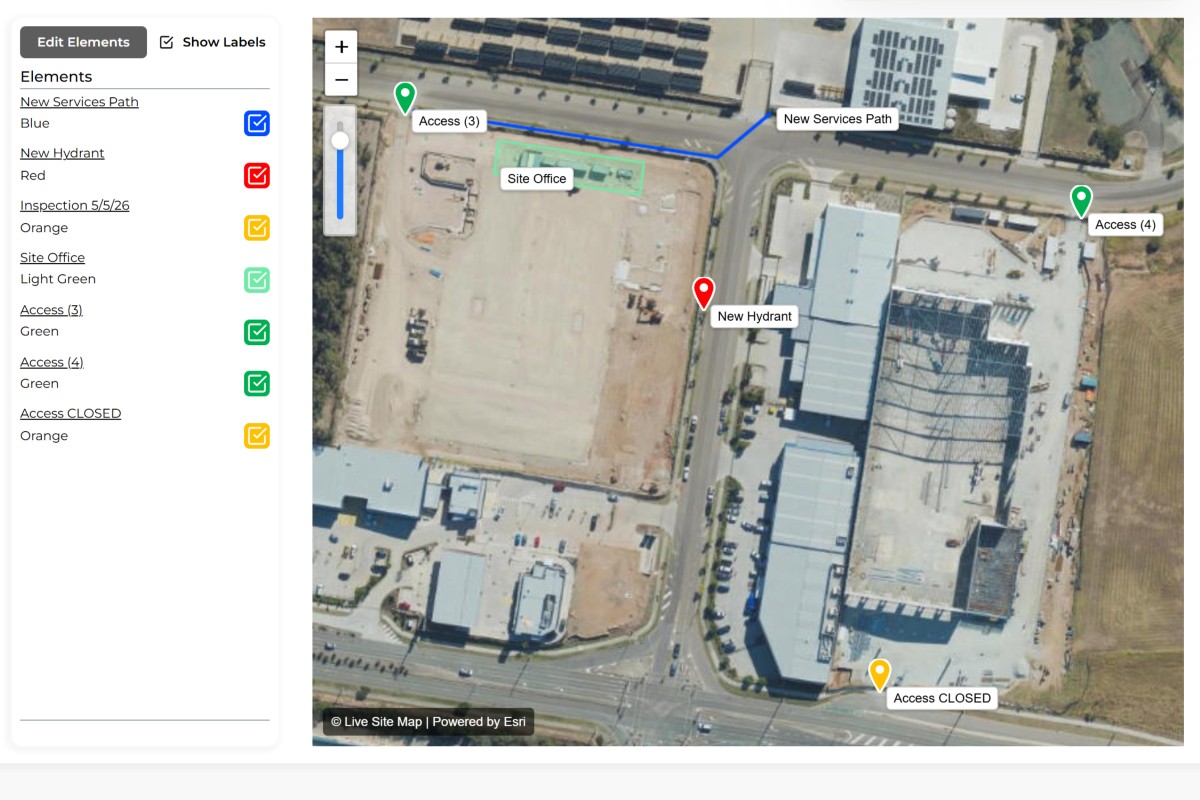
Create inspection points, areas, paths or work zones directly on a map or plan overlay to identify exactly where inspections are taking place.
Record observations, photos, notes, defects, measurements and inspection outcomes directly against the inspection location.
Track defects, maintenance requirements, hazards or non-conformances as part of the inspection record.
Maintain a complete record of inspections over time, allowing teams to review previous findings, monitor trends and verify completed actions.
Provide field teams, office staff, clients and stakeholders with access to inspection records through live links or exported reports.
Create detailed inspection records containing observations, findings, photos and supporting information.
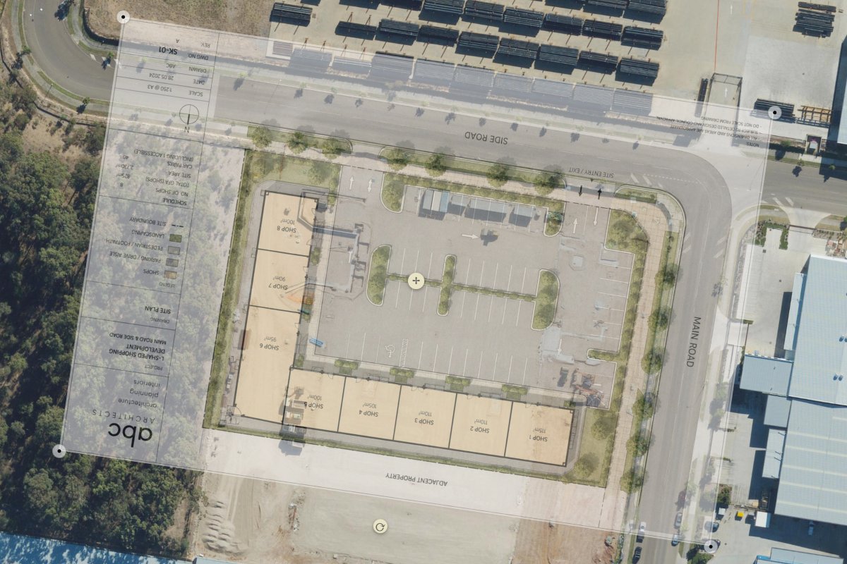
Perform inspections directly against construction drawings, site layouts, asset plans and engineering documents.
Link inspection results to the exact location where information was collected.
Organise inspections into dedicated markups for projects, assets, maintenance activities or compliance programs.
Are you struggling to keep site inspection records organised and accessible?
Many inspections still rely on a mix of handwritten notes, mobile phone photos, PDFs, spreadsheets and emails. Inspectors collect valuable information in the field, but by the time records are transferred into reports, critical context is often missing. Teams know what was recorded but not always exactly where it was found.
As projects grow larger and involve multiple inspectors, contractors and stakeholders, the challenge becomes even greater. Photos become disconnected from locations, defects are difficult to relocate, and follow-up inspections can require significant time simply trying to determine where previous observations were made. This creates unnecessary delays and increases the risk of issues being missed.
Every inspection finding can be recorded against a precise location. Photos, notes, observations and supporting information remain attached to where they were collected, making future inspections and audits significantly easier.
Inspection teams can overlay engineering drawings, site plans, utility layouts or construction plans directly onto maps. This provides valuable context when reviewing findings and allows inspectors to work against familiar project documentation.
Inspection information becomes available to office staff and project stakeholders as it is collected. Teams no longer need to wait for handwritten notes, photo transfers or manual report preparation before accessing critical site information.
When inspection records remain linked to their locations, inspectors can quickly revisit previous findings without searching through reports, emails or photo libraries.
GPS-linked records reduce uncertainty around where observations were made, helping maintain consistency across inspections and reporting periods.
Field crews, supervisors and office staff can access the same information, reducing misunderstandings and improving decision-making.
Inspection records, photos and updates remain organised and accessible, supporting compliance requirements and internal quality processes.


Site supervisors can record defects, incomplete works, safety observations and quality issues directly against locations across a construction project. Teams can revisit findings later and verify corrective actions have been completed.
Infrastructure owners can record asset conditions, maintenance requirements and inspection outcomes against physical assets across roads, utilities, facilities and public infrastructure networks.
Environmental consultants can capture observations, sampling locations, photographs and field notes while conducting environmental assessments and monitoring programs.
Facility managers can document maintenance issues, defects and inspection findings across large properties, ensuring records remain linked to their exact locations.
A construction company conducts weekly quality inspections across a large development site. Inspectors walk the site using Live Site Map and record defects as they are identified. Each defect includes photos, notes and GPS location information. Office staff can immediately review findings, assign corrective actions and track completed works. During the next inspection, inspectors can return directly to previous defect locations and verify that issues have been resolved.
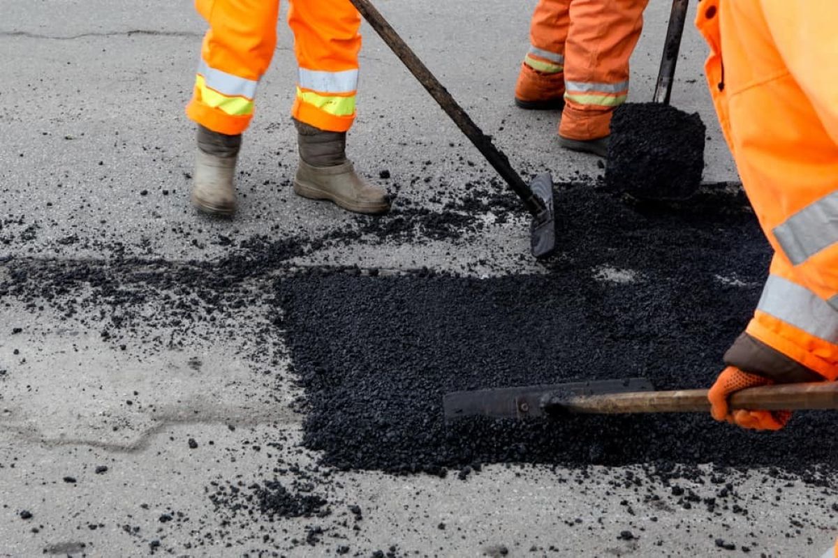
Site inspections are one of the most common activities performed across construction, infrastructure, utilities, facilities management, environmental services and asset management. Regardless of industry, inspections exist for a simple reason: organisations need accurate information about what is happening in the field.
Despite advances in technology, many inspection processes still rely on fragmented systems. Inspectors often collect information using notebooks, mobile phone cameras, spreadsheets, PDF forms and standalone reporting tools. While these methods may work for small projects, they become increasingly difficult to manage as sites grow larger and inspection volumes increase.
One of the biggest challenges is that inspection information often loses its location context. A photo may show a defect, but where exactly was it taken? A report may describe an issue, but can another team member easily locate it six months later? An observation may have been recorded accurately, but if future inspectors cannot find the same location, the value of that information decreases significantly.
This problem becomes even more apparent when organisations manage multiple sites, assets or projects. Teams spend considerable time searching for information that already exists. Inspectors revisit locations simply to confirm details that should already be available. Managers review reports while attempting to piece together where observations occurred. Valuable information exists, but it is not always easy to locate or interpret.
The operational impacts can be significant. Follow-up inspections take longer. Defects remain unresolved because their locations are unclear. Maintenance activities become less efficient. Reporting requires additional administration. In some cases, organisations may even repeat inspections because previous records cannot be easily accessed or understood.
The increasing complexity of projects is driving demand for better inspection management processes. Modern construction projects generate thousands of inspection records. Infrastructure owners manage assets spread across large geographic areas. Environmental consultants collect field data from numerous monitoring locations. Facility managers oversee multiple buildings and sites simultaneously.
As a result, organisations are looking for ways to improve how inspection information is captured, stored and communicated. Rather than treating inspection records as standalone documents, many are moving towards location-based information management. This approach keeps inspection findings connected to the places where they were recorded.
Location-based inspection management provides practical advantages. Teams can visualise inspection records on maps and plans. Historical findings can be revisited quickly. New inspectors can understand previous observations without relying on verbal handovers. Managers gain a clearer understanding of site conditions and emerging issues.
The ability to combine maps, plan overlays, GPS locations, photos and inspection records within a single visual workspace also improves collaboration. Field teams and office staff work from the same information source. Stakeholders can review findings within the context of the site rather than interpreting information from disconnected reports.
Effective site inspections are ultimately about information quality. The better organisations can capture, organise and communicate field information, the better decisions they can make. Keeping inspection records connected to their locations helps ensure information remains useful long after the inspection itself has been completed.
For organisations conducting regular inspections, the goal is not simply collecting more data. The goal is making inspection information easier to find, understand and act upon. When everyone can clearly see what it is and where it is, inspections become more valuable, more efficient and more useful across the entire organisation.